On of the key elements of the research focuses on investigating the hydrological response of High Arctic watersheds to changing climate. We use a nested watershed approach to investigate how hydrological response changes with increasing scale of the catchment areas. We also investigate catchments in that have been affected by a varying degree of active layer detachment slides to understand how permafrost degradation influences surface runoff. Another aspect of our hydrological research focuses on the subsurface hydrology, including the subsurface hydrology along the hillslope-channel continuum, and the hydrological exchange between the channel and subsurface pore waters (the hyporheic zone).
Hydrological measurements at CBAWO started in 2003 and have continued in most years to 2017. Some of these records, especially the West and East Rivers, are the longest multi-dimensional records in the Arctic (discharge, sediment, solutes, biogeochemistry).

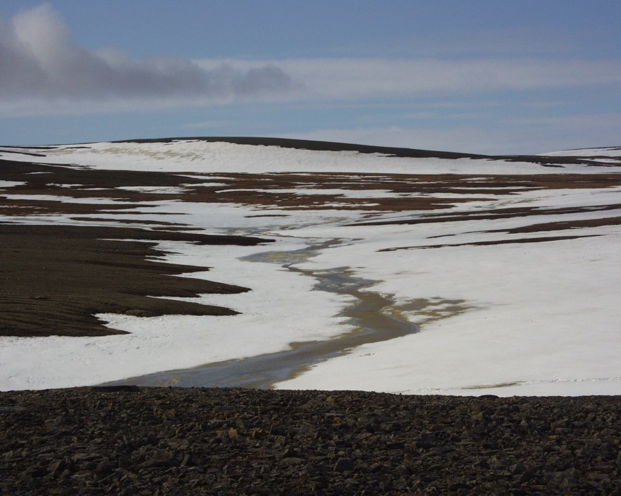
Flowing water is a key control on the mobilization and transport of sediment, organic matter, nutrients, and contaminants from terrestrial to aquatic ecosystems. Hence, quantifying the inputs, outputs and storage of water in our watersheds is fundamental to nearly every aspect of the research at Cape Bounty. Our hydrological research includes regular measurements of end of winter snow accumulation by manual snow surveys. We measure rainfall using several automated tipping bucket rain gauges across the watersheds. Surface runoff in the West and East rivers is also routinely measured from snowmelt to end of July in most years. We have also monitored runoff from a number of hillslope catchments that have been impacted by active layer detachments. These observations are necessary for any research looking to determine the mass transfer of dissolved and particulate matter (including sediment and organic matter for example) from the land to freshwater. Soil moisture and temperature in the active layer (from surface to approximately 70 cm depth) is monitored year-round at stations representing the key soil and vegetation classes in the West River watershed.
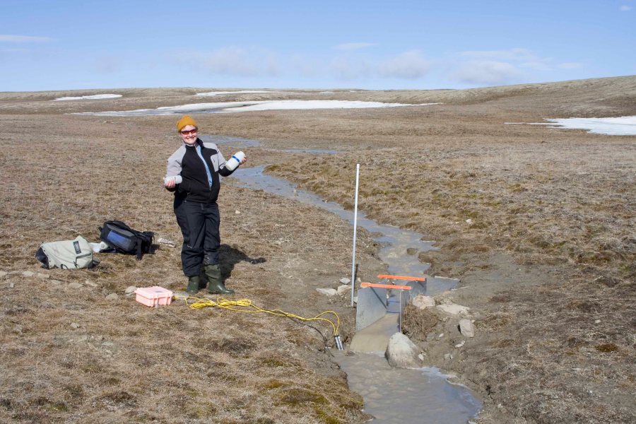
- The flume at Ptarmigan Creek, a site we began monitoring in 2006. In July 2007, upstream disturbance increased sediment and solute fluxes, and markedly changed the biogeochemistry.
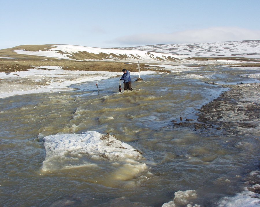
- Initial runoff in the East River during snowmelt. High discharge lasts 3-10 days and often fills the channel to capacity.