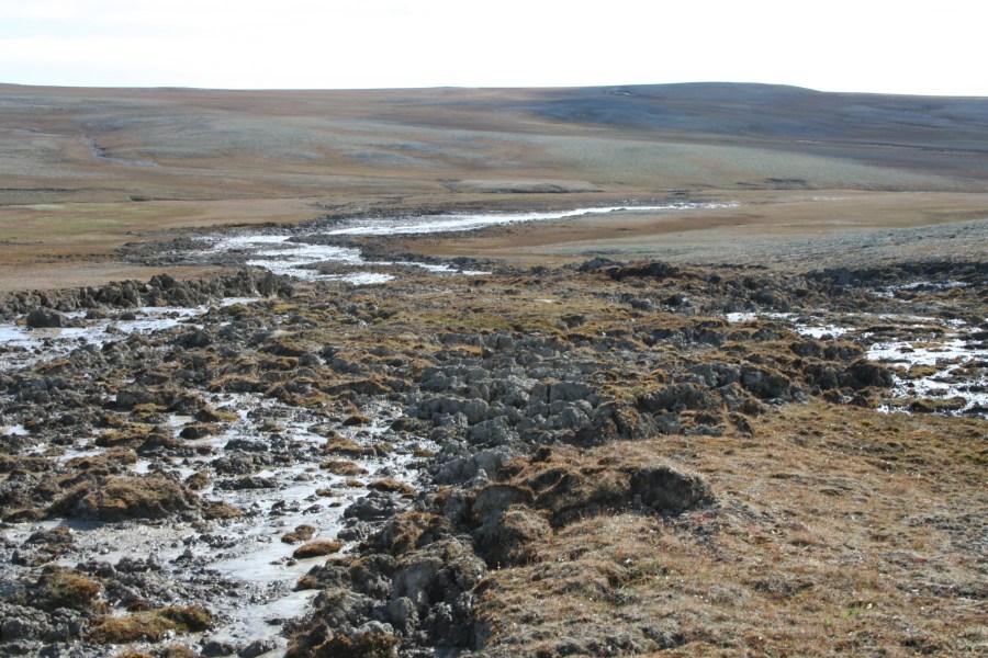
Cape Bounty is located in the continuous permafrost region and is amongst the coldest permafrost in North America. Climate in the past decade has significantly affected the permafrost through deeper seasonal thaw and landscape disturbance that has resulted in changes to the land, rivers, and water quality. There is also abundant evidence for thermokarst processes.
Research has focused on both fundamental permafrost characteristics (thermal state, ice content, distribution) and applied effects of permafrost change (land failure, thermokarst, water quality). We have established a number of borehole stations that record ground temperature to depths of 7 m, and a number of others that record the seasonally thawed active layer and upper permafrost (about 1 m depth). This data is used to determine the effects changes in weather have on active layer development and change to the upper permafrost.
We have also undertaken research to map and characterize the ice content of the upper permafrost and the base of the active layer. This involves drilling to recover frozen cores at select locations, and the use of geophysical and remote sensing techniques to locate and estimate ice content.


Remote sensing is an important tool for permafrost research as well. We use satellite radar images (DInSAR) to locate soil areas that have moved up or down to estimate the likely location of ground ice and to improve predictions of possible permafrost degradation.
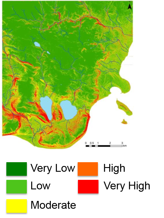
Another important approach is to determine the landscape characteristics that appear to be susceptible to permafrost change (likely due to higher ground ice content). Recent work has mapped thermokarst disturbance features and used the distribution of these features, along with other terrain factors (slope, aspect, drainage) to statistically predict where areas susceptible to this change occur on the land. Where the probability is high, we can infer that ice content or related characteristics are at risk of degradation.
We also investigate the relationships between permafrost change and a wide variety of other research topics. Most notably, hydrology, limnology and biogeochemistry.
